Pacific northwest winter weather occasionally has breaks in the clouds and rain, and one such break occurred on January 13th. So I took the opportunity to fly from Creswell (S77) to Sunriver (S21) to get some sight-seeing and practice in. I also decided to take a small Sony camera along, which would be something I hadn't done before (there are two cameras in the iPad 2 I took with me, but I felt the quality too grainy.)
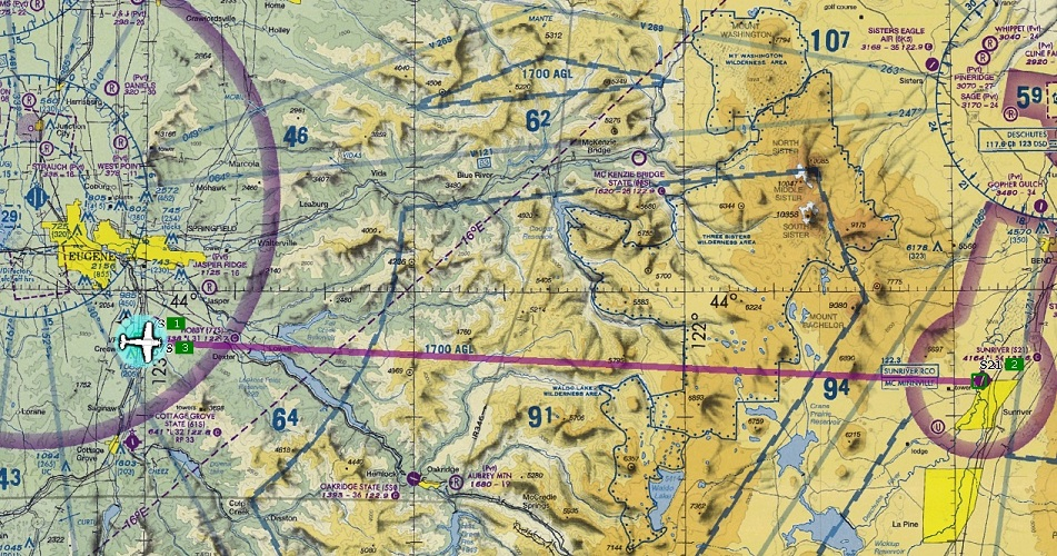
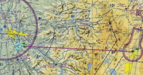
Here's the rather straightforward route:
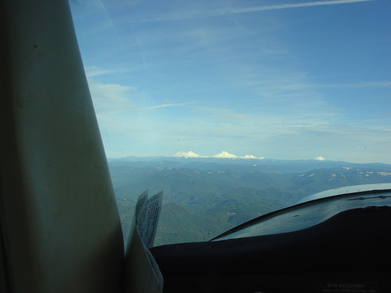
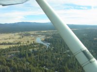
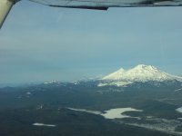
Climbing out of Creswell you can see the Three Sisters:
As you can in this photo somewhere en-route, there was not much snow on the ground at the higher elevations for so late in the season (we've gotten dumped on since this trip):
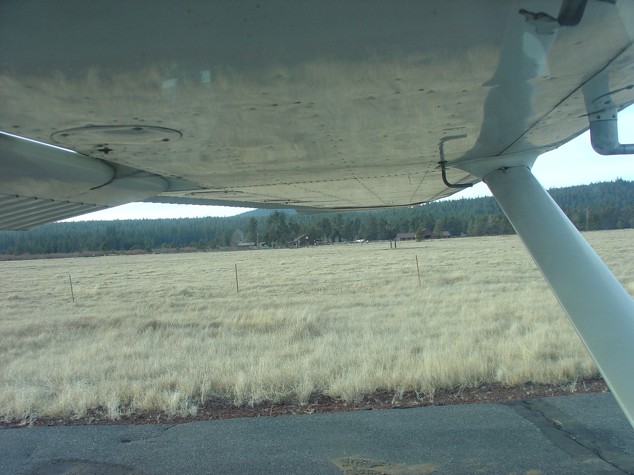
And there was almost no snow at Sunriver at that time, as seen here (on the taxiway, plane facing south, camera facing west):
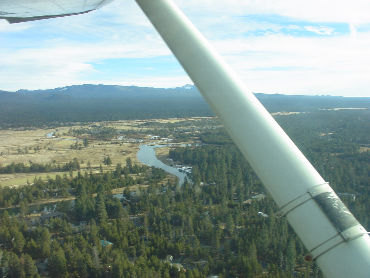
One thing I tried was to snap a photo or two on climb out (example below,) and while it is not a big distraction (I was not even using the viewfinder - just point and click in the general direction I was interested in,) it isn't something I intend to do again since getting a non-smeared photo would take too much away from flying.
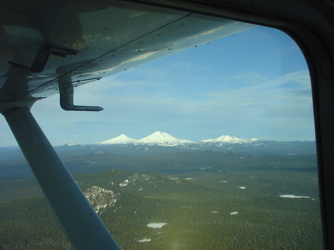
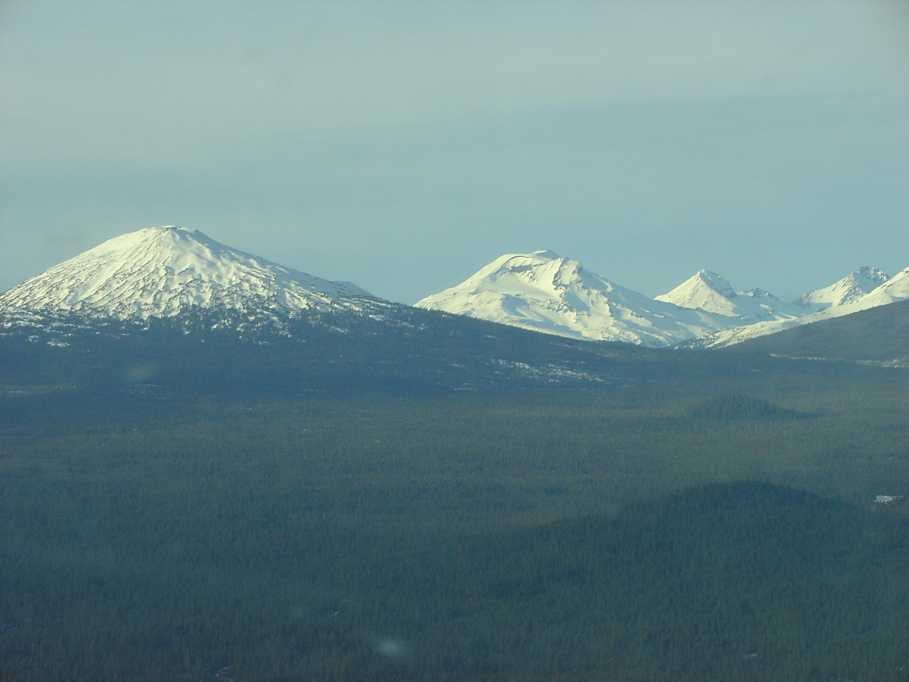
Once in level flight with everything trimmed (and smooth air!) en-route back, I was able to play with the zoom feature; first shot below is zoomed in (probably my best shot of the flight) and the second is zoomed out a few seconds later of the same general direction of the Sisters:
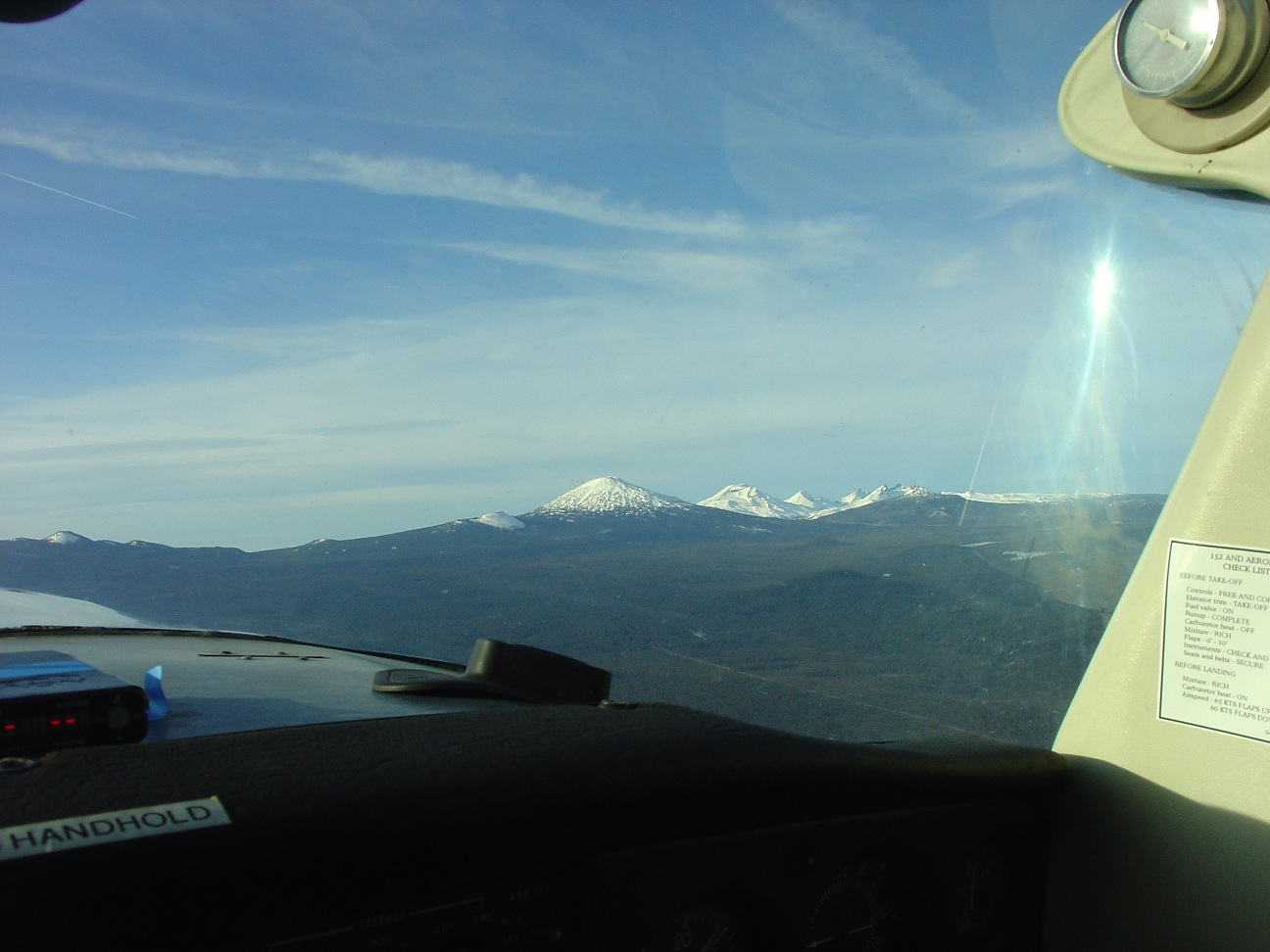
Same as above, but with different zoom; note the Dual XGPS 150 on the dash slowly sliding to one side. It normally would do a good job of staying in place, but I think there was a bunch of dust adhering to the rubber mat so it was slippier than it should have been. Works great with the iPad 2 that was alternately on my kneeboard or on the seat next to me. There is also a corner of my Zaon MRX PCAS visible - kept from bouncing around due to turbulence or my crazy flying with the use of some blue painter's tape (I tend to reuse the same strip too often):
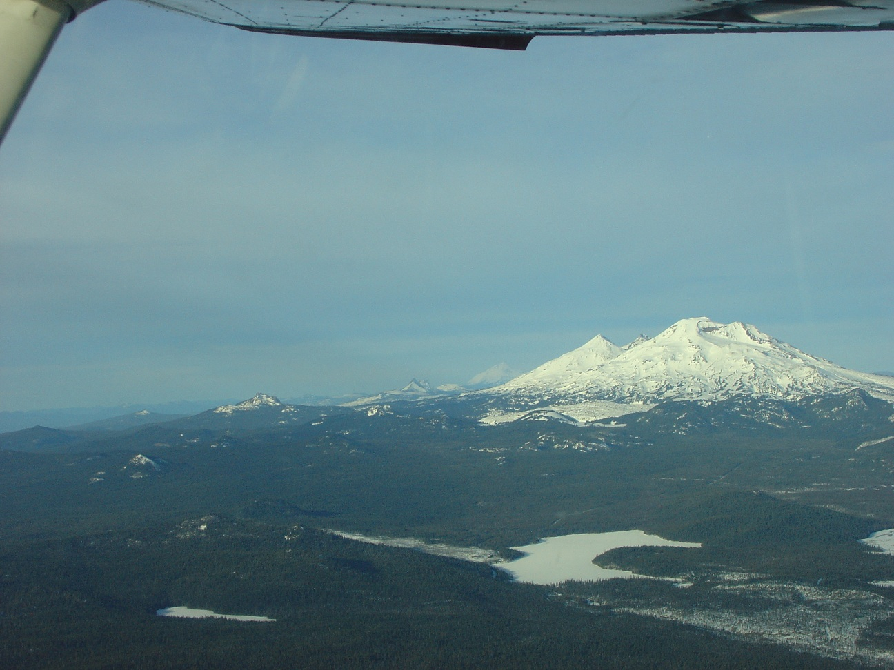
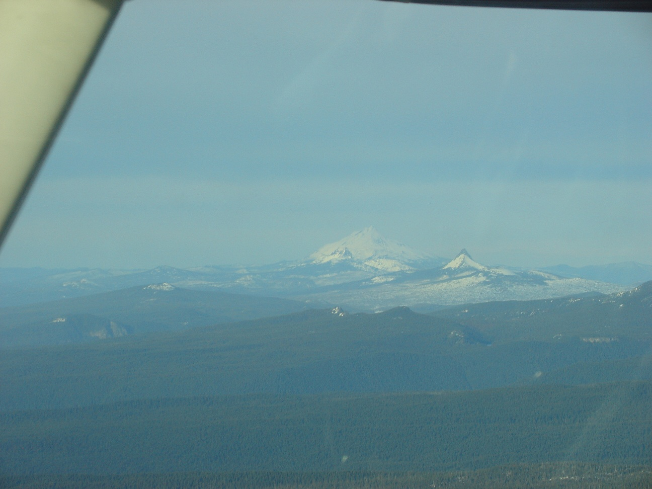
I'm not sure, but I think the more distant peak in the next two photos is Mount Washington:
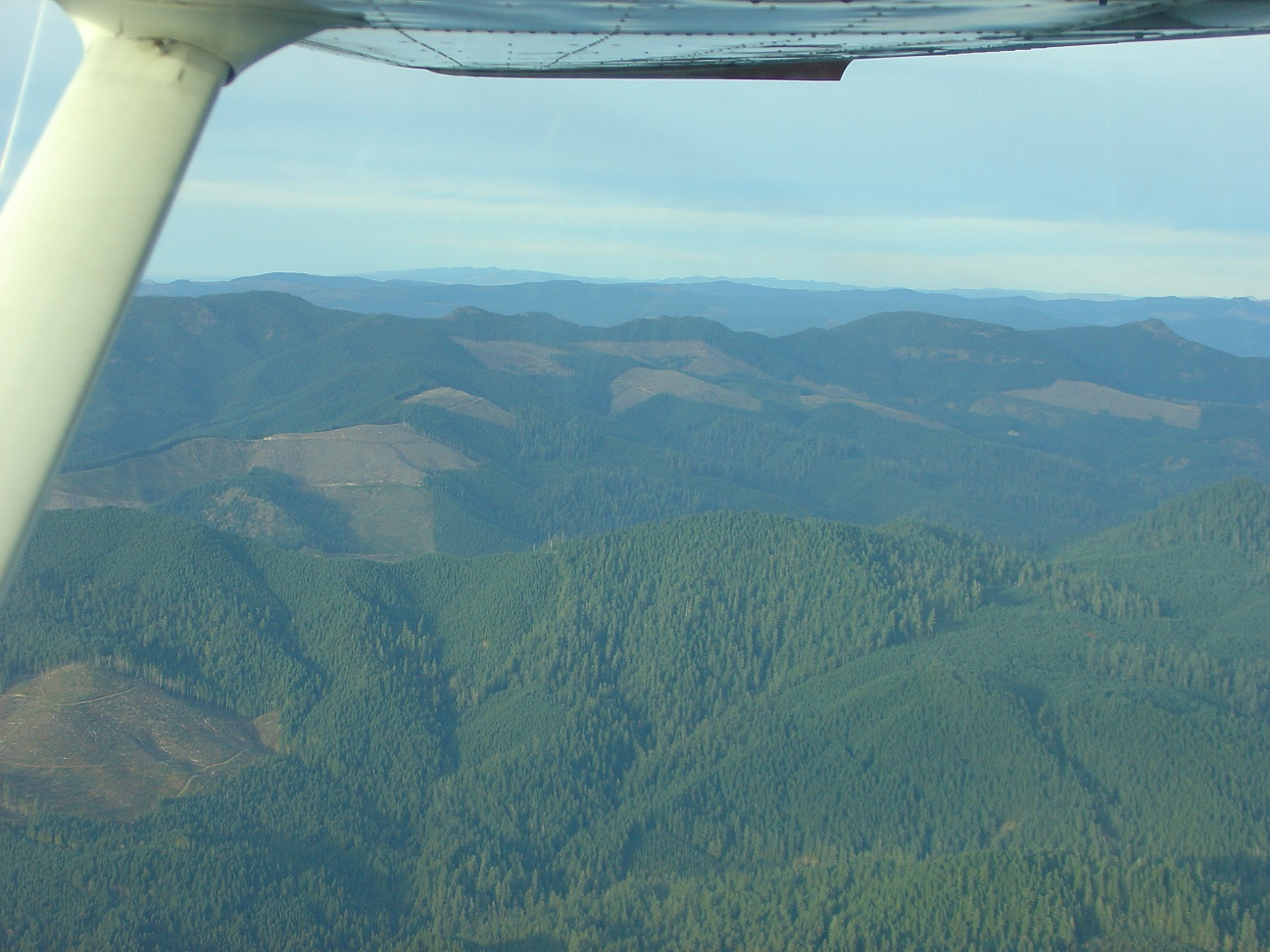
One last shot of typical Oregon mountain areas, showing areas of clear-cut logging - none of which are likely any good as forced-landing areas:
Here's the rather straightforward route:
Climbing out of Creswell you can see the Three Sisters:
As you can in this photo somewhere en-route, there was not much snow on the ground at the higher elevations for so late in the season (we've gotten dumped on since this trip):
And there was almost no snow at Sunriver at that time, as seen here (on the taxiway, plane facing south, camera facing west):
One thing I tried was to snap a photo or two on climb out (example below,) and while it is not a big distraction (I was not even using the viewfinder - just point and click in the general direction I was interested in,) it isn't something I intend to do again since getting a non-smeared photo would take too much away from flying.
Once in level flight with everything trimmed (and smooth air!) en-route back, I was able to play with the zoom feature; first shot below is zoomed in (probably my best shot of the flight) and the second is zoomed out a few seconds later of the same general direction of the Sisters:
Same as above, but with different zoom; note the Dual XGPS 150 on the dash slowly sliding to one side. It normally would do a good job of staying in place, but I think there was a bunch of dust adhering to the rubber mat so it was slippier than it should have been. Works great with the iPad 2 that was alternately on my kneeboard or on the seat next to me. There is also a corner of my Zaon MRX PCAS visible - kept from bouncing around due to turbulence or my crazy flying with the use of some blue painter's tape (I tend to reuse the same strip too often):
I'm not sure, but I think the more distant peak in the next two photos is Mount Washington:
One last shot of typical Oregon mountain areas, showing areas of clear-cut logging - none of which are likely any good as forced-landing areas:
Attachments
-
 proxy.186.JPEG788.9 KB · Views: 462
 -
 proxy.177.JPEG762.2 KB · Views: 485
 -
 proxy.178.JPEG919.8 KB · Views: 531
 -
 proxy.179.JPEG1.1 MB · Views: 457
 -
 proxy.180.JPEG921.6 KB · Views: 464
 -
 proxy.181.JPEG894 KB · Views: 474
 -
 proxy.182.JPEG751.4 KB · Views: 479
 -
 proxy.183.JPEG911.3 KB · Views: 483
 -
 proxy.184.JPEG776.2 KB · Views: 448
 -
 proxy.185.JPEG1,013.8 KB · Views: 480