How do they figure out elevation?

Captain

New member
I figure today they can use GPS to pinpoint the elevation above mean sea level of any location on earth. But how did they do it years ago? The 'mile high city' was called that way before GPS. Even has a marker on the Capitol steps at the exact spot.

So, how'd they figure it out? Anyone know?
 
Van Johnston said:
I worked as a rodman at the Tx Highway Dept for several summers in college.
Jeff Oslick said:
I earned the funds for my first 10 hours of flying lessons working as a rodman for my first flight instructor, who was a professional surveyor. I took surveying at Georgia Tech in the late 80's, and steel tapes, rods and old-time theodolites were still the order of the day.
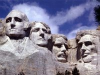
You both earned money at a profession that three of the four people in the picture below also worked at.

proxy-109-jpeg.337
 

Attachments

  • proxy.109.JPEG
    proxy.109.JPEG
    227.4 KB · Views: 120
Back
Top